
Our time in Argentina is coming to an end, but we’re going out with a boom! As soon as it became clear there would be quite some driving required if we wanted to see all that Salta and Jujuy had to offer, a road trip pretty much became the only option! The ideal route was created, a rental car was booked and accommodations were planned. Not everything went exactly as planned, but we did see everything we wanted to see! I’ll tell you all about it.
Our route
This was the route for our Salta road trip:
Day 1: Salta to Humahuaca
Day 2: Humahuaca to San Antonio de Los Cobres
Day 3: S.A. de Los Cobres to Cafayate
Day 4: Cafayate
Day 5: Cafayate to Salta
Originally…
… on day 3, we wanted to go from San Antonio de Los Cobres to Cachi. However, when we told our hosts of those plans, and they saw the car we had, they were like: ‘it’s not even recommended to do this road with a 4×4…’. So, after some more asking around, and the answers staying the same, we had to change our route a little bit.
In theory this meant we basically had to go (almost) all the way back to Salta, and then head south to Cafayate. The next morning, as we were going in the direction of Salta, we were stopped by police (not uncommon in Argentina) where the road splits in the direction of Cachi. Apparently the road to Cachi was in such bad condition, they had closed it. So, at least we already changed our plans beforehand, haha.
Picking up our rental car
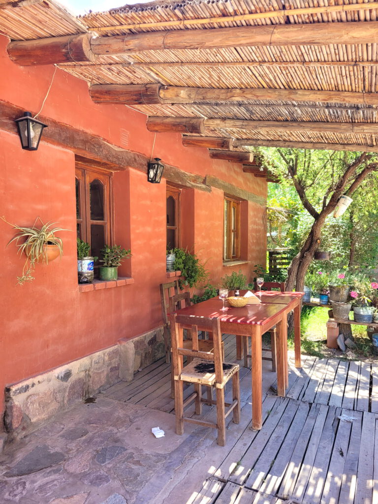
At 9 in the morning we were in the center of Salta to pick up our rental car from RADA Rent A Car for our Salta road trip. We booked a simple car, a Chevrolet Joy, which cost us $12.000 per day (≈ €31 in February 2023, with the Blue Dollar rate). RADA is a local agency with offices in Salta and Jujuy, and they had by far the best prices in the area.
Pick up went very smooth, but good to know is that their office is inside of another shop called Celushop. The car was already in front waiting for us, we just had to finish the paperwork that comes with renting a car. And, the payment of course, we had a stack of Argentinian pesos with us!
Amazingly, a second driver is free of charge! An opportunity for me to drive as well (usually Luis drives as he has more experience with these types of roads, and we just don’t want to pay extra for a 2nd driver, lol).
After everything was filled in and the pesos handed over, we checked the car for any bumps, scratches and other damages. And after that, we were off!
Day 1: Salta to Humahuaca
We headed north with Humahuaca as our destination for the day, but we would be making some stops along the way. The first part of the road is not very exciting, so we tried getting through that as fast as we could. However, the road wasn’t great and under construction. On top of that, Google kept telling us there was 60 minute congestion ahead, so that wasn’t helping here either…
As soon as we passed San Salvador de Jujuy, the traffic started. It wasn’t standing still, thank god, but it was moving incredibly slow. As soon as we hit the next town, it all became clear why it was so busy on the road: carnaval! We totally hadn’t realized that this was celebrated in the region.
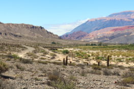
Unfortunately this meant we’d be in traffic for some part of the day as we were heading north, as all the towns have carnaval celebrations. The worst part was us (stupidly) driving into Tilcara to find the Pucára (we did find it, though), and not being able to find a way out anymore. With all the festivities, most of the roads were closed off, and there is only one way in… so we got lost, badly, haha.
Pucará de Tilcara
Pucará is an archaeological site in the town of Tilcara. The original settlement was occupied in the 10th century, but what is currently there is a rebuilt. Nonetheless, it was pretty interesting to see, and the vies from the hill over the valley are amazing!
Day 2: Humahuaca to S.A. de Los Cobres
Hornocal, the 14 colored mountain
On our 2nd Salta road trip day, one of the most exciting places was on the planning: the 14 colored mountain! It was still a short drive away though, and we weren’t a 100% sure what condition the gravel road would be in. Many Google Maps comments said it was totally fine with a regular car, but you never really know until you see it with your own eyes.
I’m glad I can say they were 100% correct, the road is perfectly fine! It took us about 40 minutes to get up the mountain, usually going around 60 km/h (which is the maximum speed). It’s very bendy and curvy, so definitely take it easy in some places, but nothing dangerous at all. Once we made it all the way up, we paid our entrance fee of 100 pesos (≈ €0,25) each, and continued up to the parking space. And then once you get out of the car…
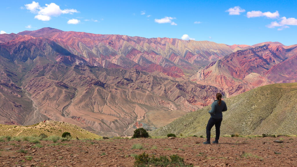
It’s so incredibly beautiful! The initial view next to where the cars are parked, is at 4350 meters above sea level. From here you can walk down a bit to the mirador (just keep in mind you also have to go back up again) to get a little bit closer to it. You’ll still be at +4000 meters, so take care when you go back up again, altitude sickness is no joke!
Purmamarca
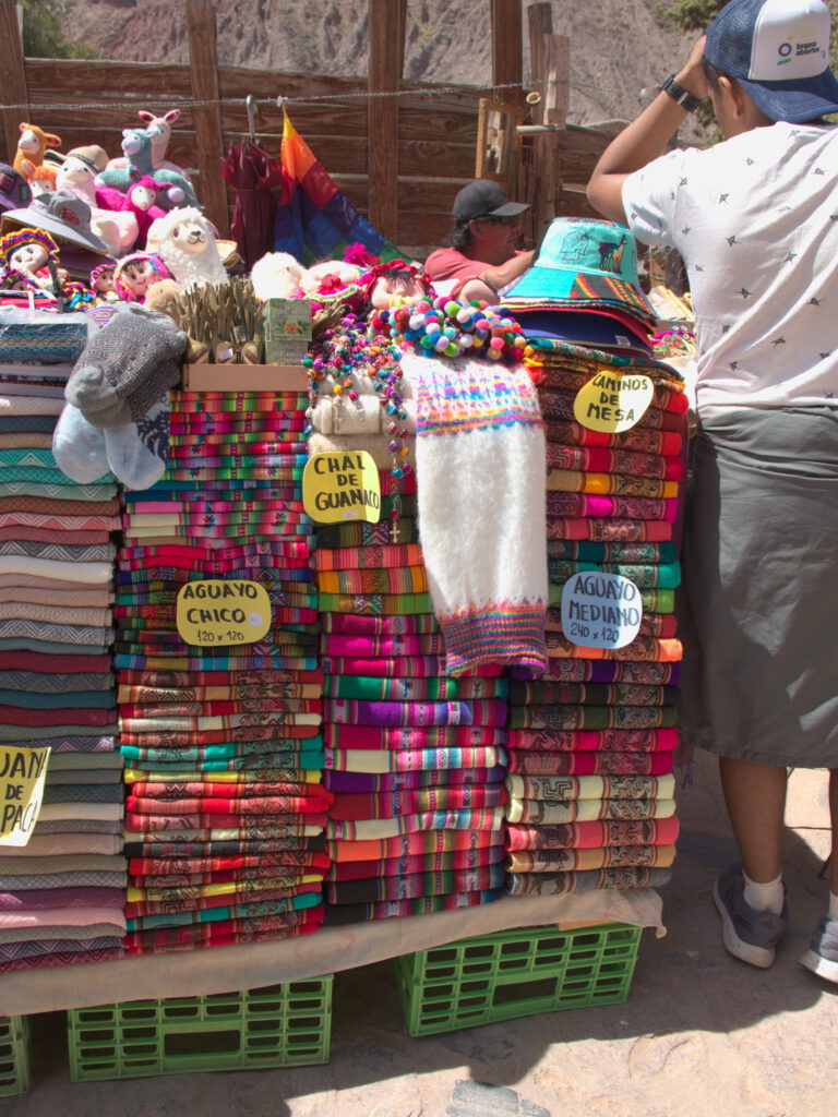
After our Hornocal adventure, it was time to start driving south again, and head for Purmamarca. This tiny, tiny town is famous for Hornocal’s smaller brother, the 7 colored mountain. We decided to make a quick stop here for some lunch, and of course walk around a bit. They had the most beautiful and colorful merchandise!
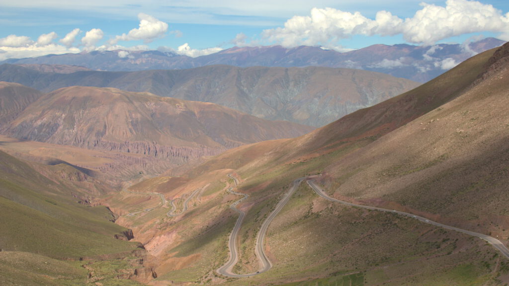
Cuesta de Lipan
From Purmamarca we headed west, in the direction of the Salinas Grandes (salt flats), but before we’d get there we’d have to pass some mountains. The Cuesta de Lipan is a zigzagging part of Ruta 52, bringing you up to +4000 meters to get over the mountains. We had no idea this would be part of the trip until it was happening! There are several miradors on the way so you can stop and get out of the car to enjoy the view.
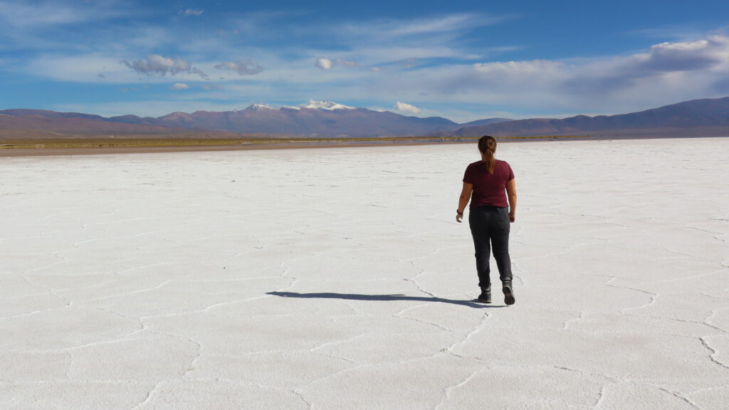
Salinas Grandes
Slowly but surely you’ll start making your way down again, and at some point you can see the Salinas Grandes in the distance.
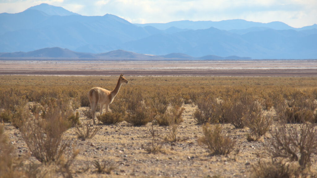
Driving to S.A. de Los Cobres
Just a couple of minutes in to our drive from the Salinas to S.A. de Los Cobres, we found a small group of Guanacos! So of course we stopped for a little bit to enjoy them in their natural habitat.
And one other thing…
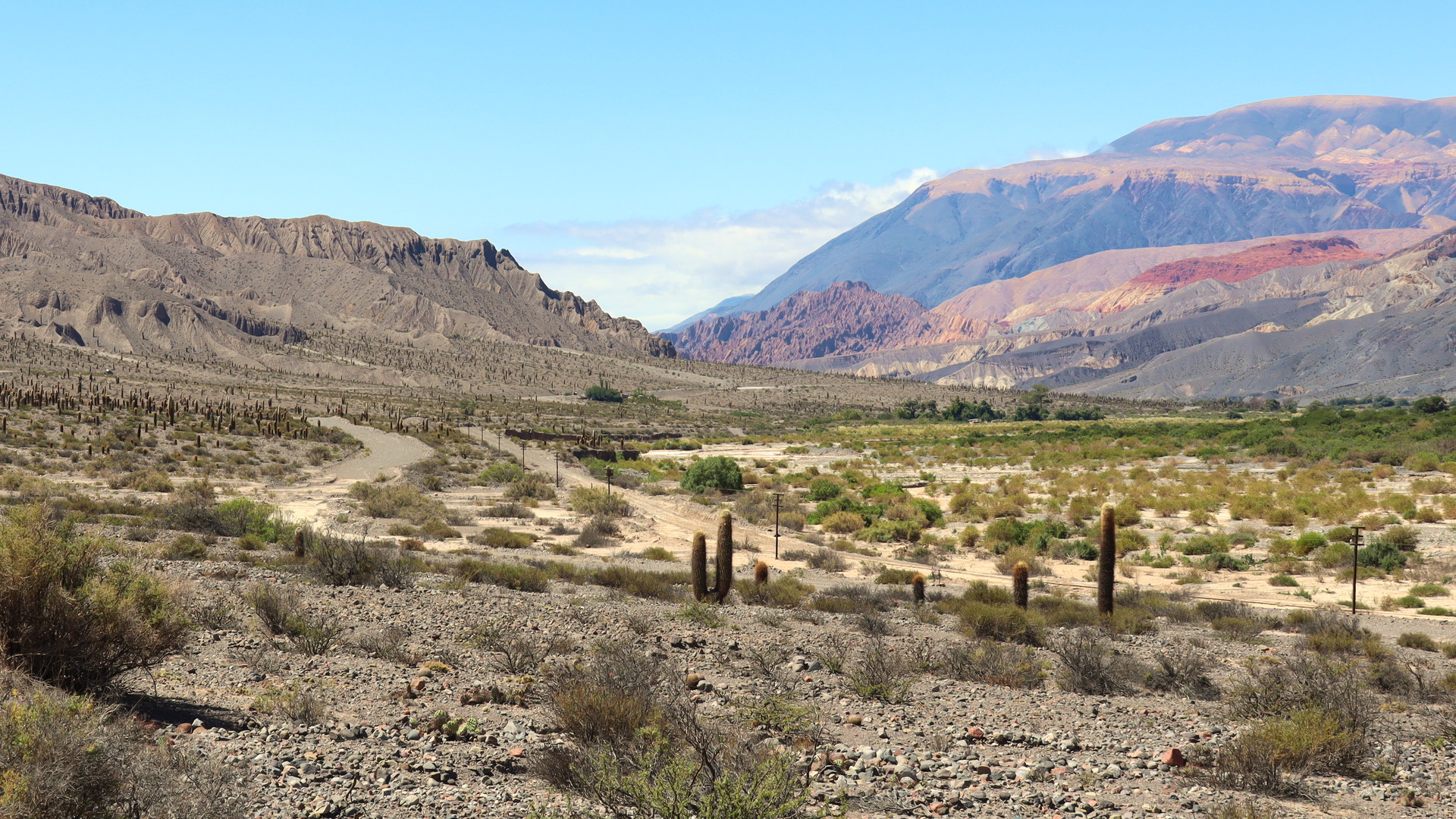
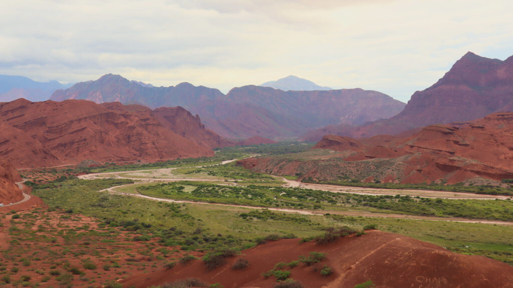
Day 3: S.A. de Los Cobres to Cachi Cafayate
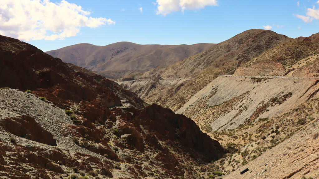
As I explained earlier, we had to change our plans to drive from S.A. de Los Cobres to Cachi, as the road was completely inaccessible (like, when we drove past the police literally wouldn’t let you enter that road). This change of plans had us driving through an area we had done no research on beforehand, so we quickly checked out Google Maps for any fun stops.
Record Mundial de Altura
One of the first places of interest comes pretty quickly after leaving S.A. de Los Cobres. You’ll start climbing up the mountains again, and once you make it to the highest point there’s a little viewpoint. Now, when it comes to views, this one isn’t fantastic, but what makes it fun is that this point held the record for highest road from 1915 until 2005!
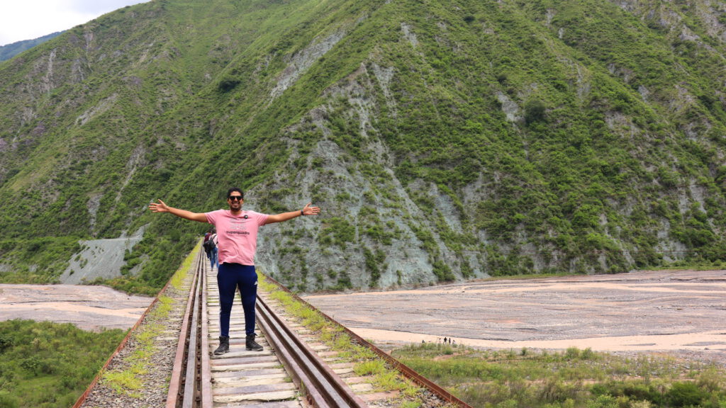
Tren a las Nubes
We knew the Tren a las Nubes left from S.A. de Los Cobres, but we didn’t know it would follow the road to Salta that we were taking! We decided not to take the train as it was VERY expensive (like, 20.000 pesos per person), but as it turns out, you can drive the exact same route. And we understand why people want to do the train, because the scenery is once again beautiful.
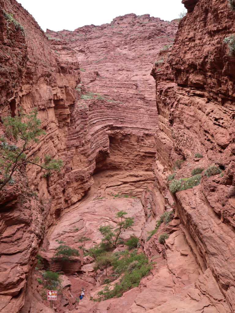
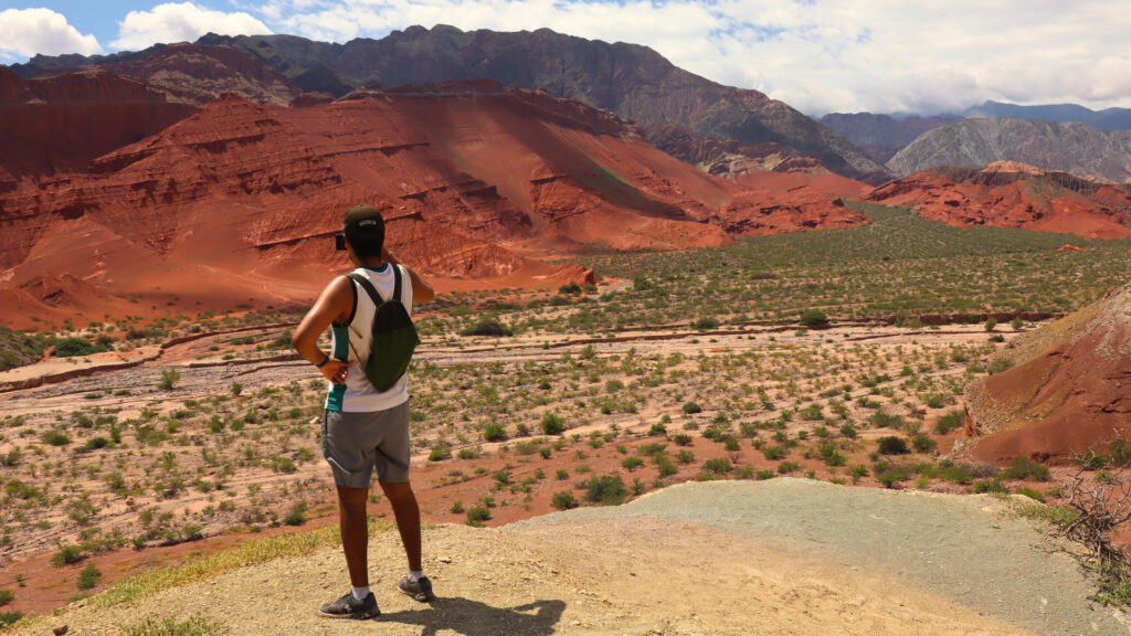
Garganta del Diablo
As soon as you hit the area that Cafayate is famous for, you’ll know why it’s so popular. The rock formations are insane, with lots of red rock and amazing views. Of course there are also many spots alongside the road you can make a quick (or long) stop, one of them being the Garganta del Diablo.
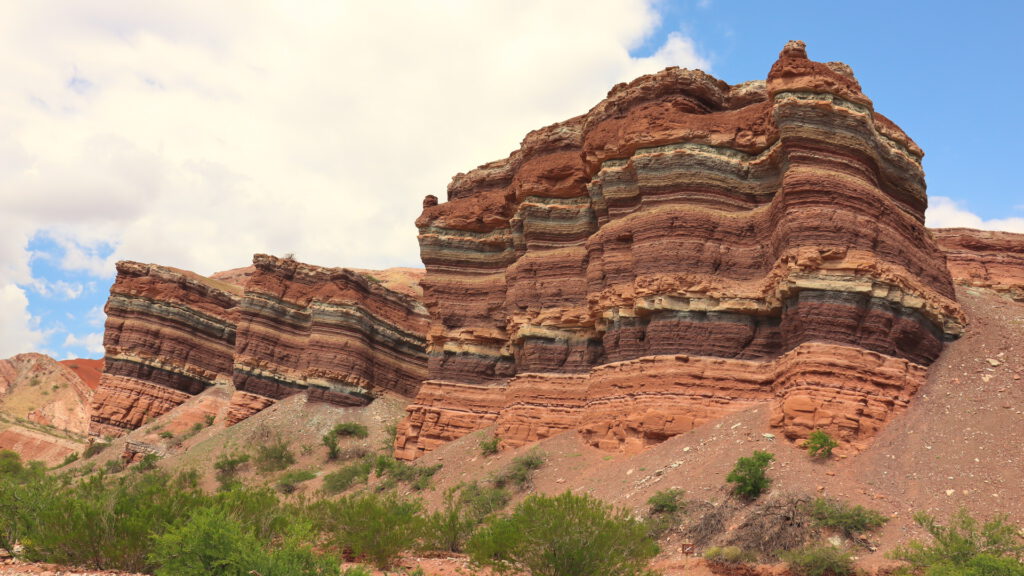
El Anfiteatro
Only a few minutes away from the Garganta del Diablo, you’ll find El Anfiteatro. We were lucky it wasn’t super crowded, so we could really take a good look at it.
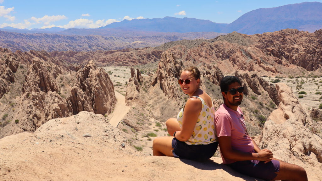
Mirador tres Cruces
Again, the next stop is not far away :P. This was our first mirador in the region, and it didn’t disappoint, although the weather was not really cooperating.
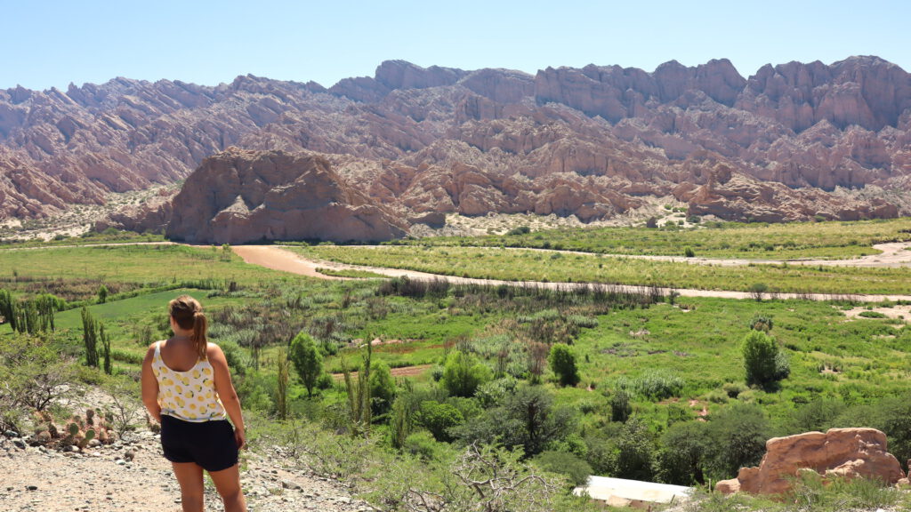
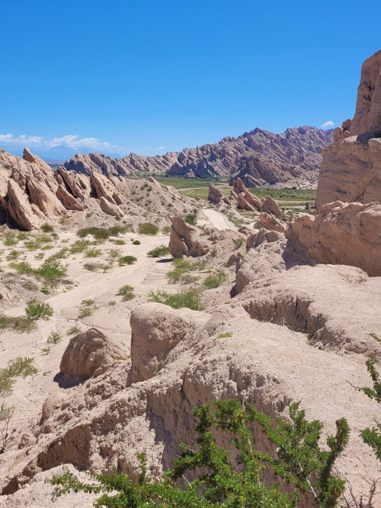
Day 4: Cafayate
As we weren’t able to drive down from Cachi to Cafayate, we decided to drive up from Cafayate instead (although, not all the way to Cachi). And as it turned out, this was a great decision. I feel like a broken record when I say again that this region is insanely beautiful. But, you know, see for yourself.
Mirador Angastaco
Starting off pretty easy with a mirador next to the village of Angastaco. If you feel like it, you can check out the town as well, it’s tiny and you can drive through it in minutes. They have an artisanal market, which was closed when we were there unfortunately, but maybe you’ll get lucky!
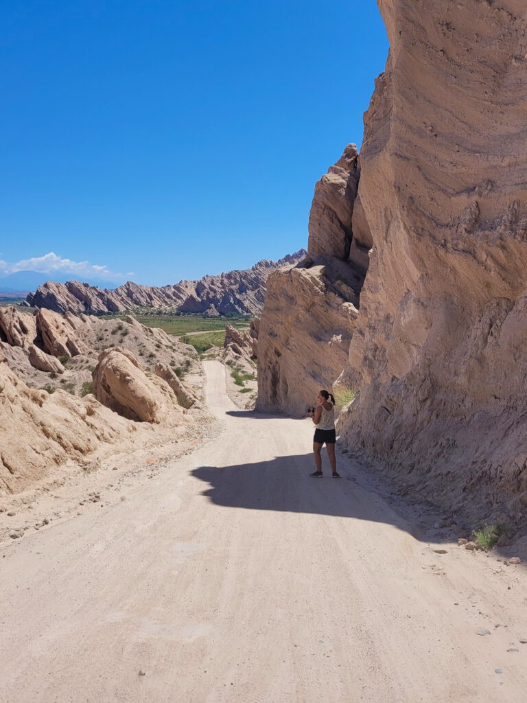
Monumento Natural Angastaco
Just a small spot to park your car on the road, in between massive walls of light stone. Thankfully it’s a very quiet road and you have the opportunity to walk around a bit.
Mirador El Ventisquero
Saving the best for last… This mirador just blew all the others we saw out of the water!
Day 5: Cafayate to Salta
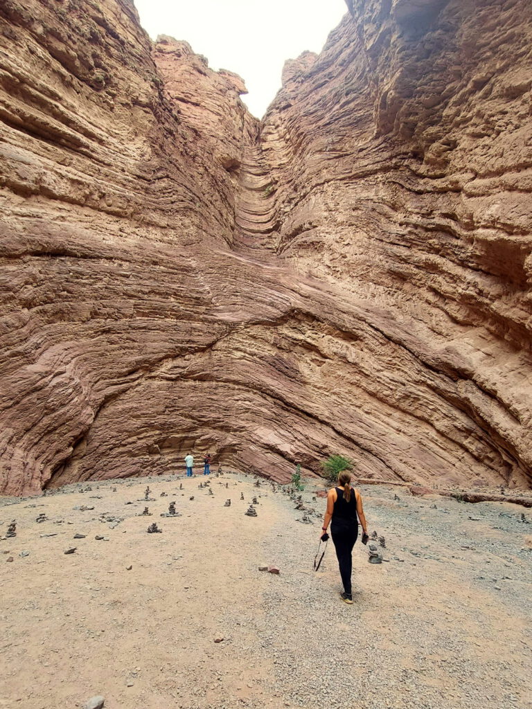
The last day of our Salta road trip has arrived… Sad! At this point there weren’t many spots for us to discover anymore, but we found one on the way back to Salta that wasn’t on our radar before. We saw some cars parked on the side of the road, so thinking there was something to see we pulled over as well. It turned out to be a little trail to La Yesera.
La Yesera
Having no idea what La Yesera exactly was, we started to walk. The sign said it should take around 30 minutes to get there, so that was short enough for our tired bodies to give this a try. We could already see the views would probably be pretty good, so at least it wouldn’t be for nothing if La Yesera itself turned out to be something not-super-exciting.
But, La Yesera itself was pretty cool! In this region there are quite some mountains with several colors, and here you could see them in the layers of the rock.
And now, on to Bolivian adventures!